Thursday/Friday February 27/28 2025 -Tennessee road trip days 1/2 - Little walking
It seemed like it had been planned for a year but it’s finally here. Our first night started off Thursday after work around 4 pm. We headed southwest through the Allegheny’s and, after a fun casino visit, into Pennsylvania. We stayed in Clearfield PA at a Best Western that was especially quiet, nice and well thought out for the modest price we paid.


After a somewhat short night of sleep we began what will probably be the longest drive and longest day of the entire trip. Brian drove us from Clearfield down to the Flight 93 Memorial site in Shanksville PA. I had been to the memorial once before but Brian had never been. It was a very quiet somewhat blustery visit to the memorial which added to the somber tone that place already has.
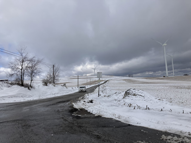
On the way:


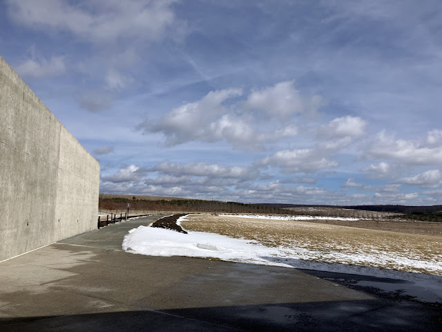
At the memorial:


I think the photos I’ve taken accentuate the abstract nature of some of the memorial elements. There are much more straight forward pieces to it. For example, the black brick walkway that leads from the Learning Center to the sculptural pieces shown in the last photo represent the actual path Flight 93’s last moments covered and periodically there are engraved timeline events of the various aircraft involved in 9/11. They are very terse and just say things like 8:01 am flight xx crashes into WTC x or whatever. I immediately choked up walking along that path because being reminded of those events in such a stark manner was very moving.
No photographs are allowed in the visitor center’s exhibit space. It isn’t a huge museum space but the timelines, debris from the aircraft and a lot of electronically browsable information on each passenger and crew member certainly do what needs to be done.
The abstract wall pieces are on top of a hill near the visitor’s center. There is another area of the memorial in a wide pond filled field (the area was previously a strip mine for coal) and that area has the wall of names and walks directly adjacent to the debris field and near the impact site etc. The photos of the beautiful curving bridge are from a hiking trail which connects the two areas. We were a little pressed for time so we drove between them but some day I hope to do the mile long walk through the beautiful, quiet and introspective grounds of the memorial. The amount of land preserved for this project is immense. The entry road to the site is over 3 miles long.
Some aspects of the memorial seem a little over the top. The wall of names is a series of tall marble panels, each with just 1 person’s name on them. It’s a nice tribute but no amount of marble or stone can bring those people back and the location of the wall of names at the end of a long, relatively featureless walk means it’s probably increasingly going to be a monument that stands alone and minimally appreciated for years. I enjoyed visiting again and I wish there were thousands of people each month who wanted to come and have a peaceful moving experience but Brian and I both wondered aloud how many people visit now and how many fewer will come in a decade.
After the memorial we headed south, Brian driving, mostly on US-219 into Maryland and then onto I-68 West. At that point I drove for several hours. Traffic was light all day, very very light mostly, but there were many construction zones and a few random stop and go spots from police activity or whatever. Driving through West Virginia is interesting. There are basically 2 kinds of roads in WV.. There are 4 lane expressways (maybe or maybe not full Interstate level) and there are goat paths. Even the 4 lane expressways, EVEN Interstate 79 in particular is constantly curving and climbing mountains and dropping into hollers. I’m not exaggerating when I say that I-79, in the 250 miles we drove on it, probably had 5 miles of straight pavement. Most of the miles were pretty intense curves for the 70 MPH speed limit. It’s very stimulating and fun, kind of like driving US-101 North of Uriah CA through the redwoods. Beautiful, fast but never easy. We had a surprisingly tasty dinner at a West Virginia fixture, Gino’s Pizza and spaghetti house. Certainly not gourmet but surprisingly enjoyable.
After dinner, just past Charleston WV, I opted to get off the Interstate and take US-119 despite it being dusk and adding an hour and 10 minutes to our already lengthy trip. We were going to be on I-64 and I-75 otherwise and Brian probably wouldn’t want to drive on either plus I think I-64 is pretty congested for much of it’s length in Kentucky. US-119 was basically just like the other West Virginia roads, curvy and fast moving but very light traffic. The lack of safety features is striking on their roads. Most of US-119 was posted for 65 MPH and even in suburban areas with stoplights, there were NEVER any flashing lights indicating to prepare to stop nor were there any stepped down speed limits as you approached intersections. It was all 65 MPH. Tennessee has roads similar to that but they always step the speed down to 55 then 45 before going through an intersection then back to 55 then 65 on the other side. Kentucky uses ‘prepare to stop when flashing’ signs that give you a pretty good idea if you will be rolling through or needing to stop. West Virginia, on both US-119 and US-219, seemed to opt for neither. Still, as somebody who likes to drive and sometimes misses the curvy hilly places I used to live and visit, it was a very fun day of driving.
We arrived at our hotel in Helenwood TN around 10 pm. It was a long day but really quite enjoyable overall and we’re excited about our first hike of the trip on Saturday and arriving at the state park West of Nashville Saturday afternoon. In between we will traverse 250 miles of TN East to West and pass through the Big South Fork recreation area and go through a lot of what I hope is still quiet rural Northern TN, skipping over Nashville and most of the other bigger towns.


Comments
Post a Comment