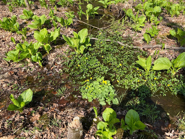
Thursday April 8th, 2021 - Horse-Shoe Loop Tail, Middle Creek Wildlife Management Area - Near Lititz PA - 13 miles - About 2100 feet elevation gain
Thankfully I woke up Thursday feeling 100% normal and well. We both slept well and the morning was sunny and bright but not as stuffy or still as it was for the hike the day before. We went to a bagel place we'd been to years ago here in Harrisburg for breakfast. The drive to the trailhead was only 50 minutes and about 20 of that was along the Pennsylvania Turnpike which I really like. In actuality half of my 20 miles on the Turnpike was a single lane construction zone but there was no backup at the merge point so it wasn't too slow. The trail's starting point was just a nicely widened section of shoulder on a road with very little signage or notable features.
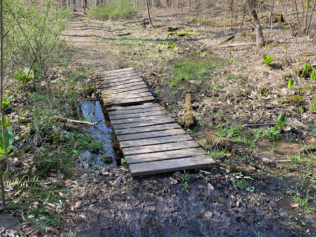
This hike was interesting in so many ways. First, literally the first or 2nd step off of he road brings you to the split where you go left or right for the loop. And regardless of if you go left or right, the first few dozen steps of the trail for us were going to be on rounds of trees placed to provide somewhere to walk through what must be a wet area much of the year. We went counter clockwise for a minor but specific reason. One of the comments on Alltrails said that when you get to the very farthest away point of this long walk, the plotted trail says to cross a creek but the poster said (accurately) that you needn't cross that creek at all and his description of avoiding the creek was based on going counter clockwise so that's what we did.
The first mile or so of our walk was along the creed (Middle Creek?) and it was very soothing and gentle. Later we made a sharp right turn and had some moderate up hill climbing to do. We reached a junction at about 2 miles. This junction marked the first half of the first loop. The entire hike has 2 loops (one larger than the other) and a hefty long string or stem between them. Basically you could all it a figure 8 trail in very loose terms but the step was very exaggerated and the loops not very round. For some reason in my imagination the loops would be the action spots of the hike and the stems some boring connector trail The reality was closer to the opposite. The stem was on a narrower foot path that went steeply up and down 2 rises of several hundred feet. The second (more distant) loop was almost completely a grassy gravel road with only gently ups and downs. Since the stem had to be walked both ways, that made up the majority of the elevation gained. At one point walking along a wide section of the path I noticed a little side trail on the phone that curved around a knob or bluff and commented on it to Brian as we went by the junction. What I didn't realize was that the junction wasn't the path TO the little side trail, the junction to the narrow trail was what we needed to follow. It really felt natural to keep walking the way we'd been going on the wider trail so I didn't look at my phone until we were getting close to what appeared to be a dead end on the road. That's when I realized that we'd been off track for at least .75 miles and had lost a fair bit of elevation. So our ambitious long hike got a little longer and more ambitious.
We finished the hike feeling tired (not surprising) but free from any obvious injury. The weather and air quality were perfect, temps hit the lower 70's with a pleasant breeze. The hike had various valley views and some nice ridge climbing. One negative was that there was almost no point along the trail where there wasn't easily noticed road noise either from the Turnpike which is not far from parts of this trail, or a busy regular road the trail goes by in another section. So there was no sense of wilderness exactly to this hike but as a challenge and an interesting piece of PA to explore it was a hit.


Comments
Post a Comment